Hinch Mountain
Head of Sequatchie to Stinging Fork Falls TH
Overview
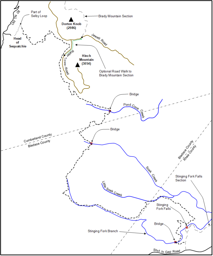
This Section as described here is 17.3 miles one way starting near Stinging Fork Falls in Rhea County and ending at Head of Sequatchie. It goes northwest crossing through Bledsoe County and then into Cumberland County. The trail follows and bridges Stinging Fork Branch upstream of Stinging Fork Falls for part of the section.
It also follows along Little Soak Creek as well as Soak Creek, and crosses Soak Creek on a bridge near a beautiful wet weather waterfall. The trail crosses Pond Cove Creek on a wooden bridge before climbing through Hinch Gap onto the shoulder of Hinch Mountain above Head of Sequatchie. Through-hikers can exit the trail and do a short road walk on Radar Tower Road and Jewett Road to reach the southern terminus of the Brady Mountain section. Point-to-point hikers can stay on the trail and take it down to Head of Sequatchie.
Trail Section Details
Features:
- Waterfalls
- Overlooks
- Swimming
- Wildflowers
- Fall color
- Bluffs
Counties:
- Cumberland
- /
- Bledsoe
- /
- Rhea
Distance:
17.3 miles
Difficulty:
Strenuous
Elevation Change:
2100 feet gain south to north, 2700 feet north to south
Northern Terminus:
Head of Sequatchie (35.792814, -85.007763 • Elevation: 1,109 ft)
Southern Terminus:
Stinging Fork Falls Trailhead, on Shut-In Gap Road (35.71508, -84.92843 • Elevation: 1,677 ft)
Timezone:
The hike as described south to north starts in the Eastern Time Zone and finishes in the Central Time Zone.
Cautions:
Wet weather crossings
Camping:
Two designated campsites
Water Sources:
There are no safe water sources along this section of trail. Bring your own drinking water; filter, boil or sterilize all water used for cooking.
Trailheads
Stinging Fork Falls Trailhead; from the intersection of US 27 and TN 68 in Spring City take TN 68 north for 1.4 miles and turn left on Shut In Gap Road. Drive 5.1 miles on Shut In Gap Road to the signed parking area on the right.
Head of Sequatchie Trailhead; see the CTC Head of Sequatchie page (link below) for directions and hours of operation when the gate to the parking area is open. The trail as described here ends at the bridge crossing Sequatchie River as it emerges from a small cave behind the Visitor Center.
Map
Description
Note: The description is provided from south to north.
South to North (North to South)
Mile 0.0 (17.3) Leave the parking lot heading due north next to the trail kiosk. At 0.2 miles reach a signed junction. Going straight leads to Stinging Fork Falls and the section heading south. For this hike turn left for the Cumberland Trail North. Immediately come to a blaze and Cumberland Trail logo on a post and a newly cut logging road. Cross the road and follow the trail left as it runs parallel on the right side and slightly below the road. At 0.3 miles reach another post with an arrow pointing right (and another pointing left for southbound hikers). Descend on well-built steps heading generally left and down toward Stinging Fork Branch where the trail weaves through mountain laurel and hemlocks.
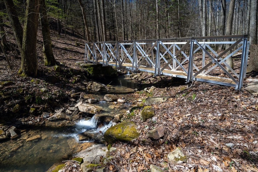
Mile 1.5 (15.8) Cross Stinging Fork Branch on an aluminum bridge with grated deck at a pretty spot as the branch flows to the right toward the waterfall. Bear right after crossing the bridge and gently ascend away from the branch. The trail levels out and travels through stretches of pine trees with soft needled footing. The trail crosses five or six easy wet weather branches on this stretch as it heads north and east on the rim above Stinging Fork Branch and the waterfall to the right. At 2.0 miles the trail turns left and walks along a straight roadbed covered in pine needles.
Mile 2.1 (15.2) Reach a cable across the roadbed and go around the cable through a gap to the left for hikers. The road goes straight onto private property. The trail turns right into the forest on single file immediately after passing the cable. The trail heads north and west and at 2.5 miles starts descending toward Little Soak Creek. Cross a wet weather branch and then reach Little Soak Creek at 2.8 miles. This creek flows to the right and eventually into Soak Creek. Cross the creek on stepping stones and bear left following the creek upstream. The trail continues upstream crossing the creek three more times over the next 0.4 miles before climbing steeply out of the gorge and crossing into Bledsoe County from Rhea County.
Mile 4.0 (13.3) The trail goes through a clearing at 4.0 miles and heads south then west on mostly level ground. At 5.0 miles the trail goes straight across a gravel road and then descends slightly to reach Stinging Fork Branch again at 5.2 miles. The trail follows Stinging Fork Branch upstream for about a mile through mountain laurel tunnels with the branch on the left. At 5.5 miles cross a wet weather branch coming in from the right. At 6.7 miles the trail turns sharply right and begins a steep ascent leaving Stinging Fork Branch for the last time. The trail climbs about 400 feet over the next 0.7 miles with an unnamed wet weather branch on the right. The climb ends at 7.4 miles and heads northeast on the shoulder of Holloway Ridge for another 0.6 miles. During this stretch the trail crosses back and forth over ATV roads five or six times so pay close attention to the trail blazes. The trail then descends 400 feet on switchbacks into the Soak Creek gorge over the next 0.7 miles.
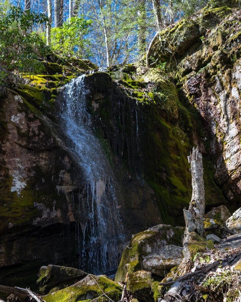
Mile 8.6 (8.7) Just before the trail reaches Soak Creek it goes above a wet weather waterfall to the left and then descends to the base of the falls. The waterfall cascades down moss-covered rocks and has been christened Keeton Falls in honor of Savana and Dusty Keeton longtime trail builders for the Cumberland Trail. The trail descends 0.1 miles past the waterfall and bridges Soak Creek on an aluminum bridge with wooden deck at 8.7 miles. After crossing the bridge bear right then switchback left and begin a steep 550 foot climb over the next 0.7 miles. At 9.4 miles complete the climb and at 9.6 miles leave Bledsoe County and enter Cumberland County. The trail heads northeast gently descending before starting a steeper descent to Pond Cove Creek at 10.4 miles.
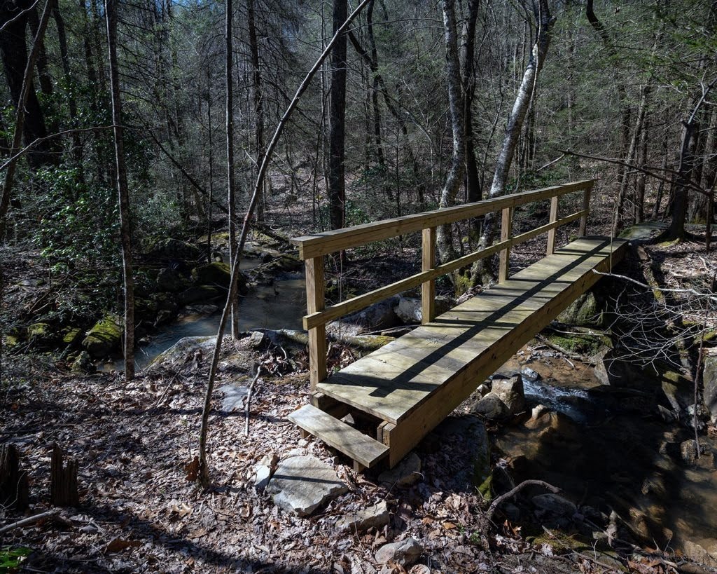
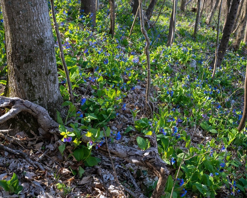
Mile 10.7 (6.6) Descend about 200 feet and reach a wooden bridge crossing Pond Cove Creek at 10.7 miles. Turn right after the bridge and then curl left immediately around large boulders. Just after passing the boulders a yellow-blazed trail leads up to the right to a campsite. The trail now heads west and slightly north for 1.3 miles climbing gradually through Hinch Gap onto the shoulder of Hinch Mountain. The trail passes an impressive near perfect 90 degree bluff elbow at 11.5 miles. During springtime an impressive display of wildflowers begins here and continues until the trail terminates at Head of Sequatchie.
Mile 12.0 (5.3) At 12 miles the trail crosses a dirt road that veers down from Radar Tower Road above. The trail then descends about 300 feet over the next 0.4 miles. The trail heads north and climbs gently on the shoulder of Hinch Mountain for the final 1.3 miles. During this stretch the trail hugs impressive vertical rock bluffs for about 0.3 miles and in winter and early spring affords peekaboo views of Sequatchie Valley south of Head of Sequatchie.
Mile 13.7 (3.6) The trail reaches a junction and veering right a few steps emerges onto Radar Tower Road at 13.7 miles. Through-hikers can walk left on Radar Tower Road 0.5 miles to reach Jewett Road and then walk right 0.35 miles on Jewett Road to reach the southern terminus of the Brady Mountain section. Day hikers can proceed straight at the junction instead of veering right and take the trail down to Head of Sequatchie.
Mile 15.1 (2.2) The trail continues parallel and below Radar Tower Road for 0.4 miles then veers left and starts following below Jewett Road for about a mile. This section is on a bench with moderate grade and smooth footing. At 15.1 miles the trail turns left and begins a steep descent.
Mile 16.0 (1.3) The trail descends steeply on a series of switchbacks as it heads generally southwest. Many of the switchbacks are constructed with stone steps. At 16 miles the trail levels out and veers right heads northwest toward Head of Sequatchie.
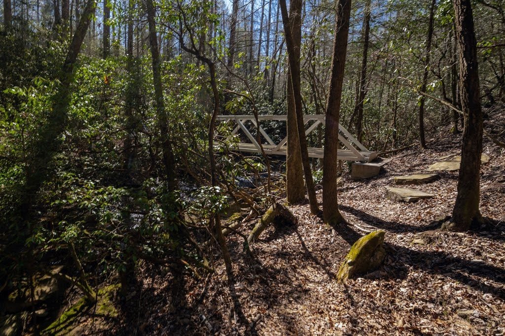
Mile 16.9 (0.4) Cross a small wooden bridge 16.5 miles and reach a junction with the Selby Loop trail at 16.7 miles. Going either direction will reach the northern terminus, but for this description go right as the Cumberland Trail is shared with the Selby trail for 0.2 miles. Reach a second junction at 16.9 miles. At the time of this writing the trail to the right (north) reaches a dead end on Hinch Mountain. It may connect to the Brady Mountain Section in future. Bear left at the junction to leave the Cumberland Trail, now on the Selby Loop trail.
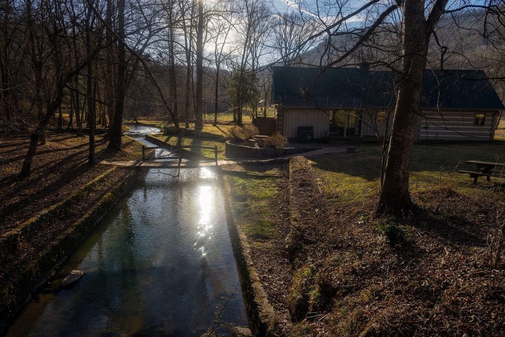
Mile 17.3 (0.0) The Selby Loop Trail descends at a moderate grade and reaches the northern terminus at 17.2 miles at a sign next to Sequatchie River where it emerges from a small cave (see photo).
– Gary Stephens, CTC Volunteer