McGill Creek
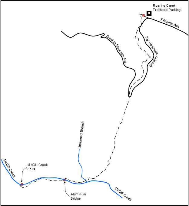
Brayton Rd (Roaring Creek TH) to McGill Creek Falls
Overview
This Section is currently IN and OUT only, starting at the northern terminus Roaring Creek trailhead. The trail is 2.8 miles one way and roughly follows Brayton Mountain Road for the first 1.1 miles. The trail then crosses the road and travels south then west into McGill Creek Gulf and descends to McGill Creek at 2.2 miles. The trail bridges the creek at 2.4 miles and follows the creek upstream on the south bank, reaching a short spur trail to McGill Creek Falls at 2.8 miles. The trail currently ends at the waterfall.
Trail Section Details
Features:
- Waterfalls
- Overlooks
- Swimming
- Wildflowers
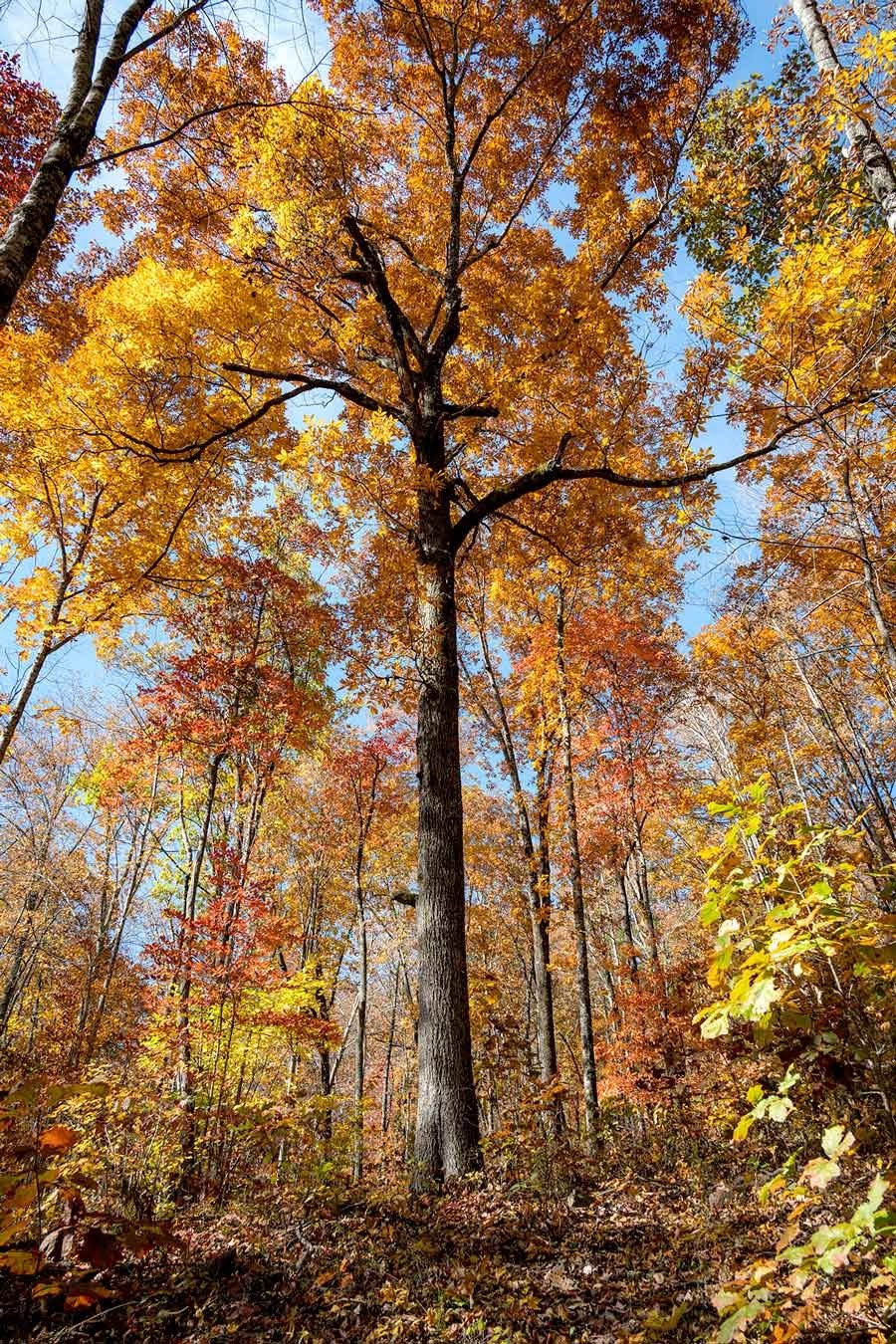
- Fall color
Counties:
- Rhea
- /
- Hamilton
Distance:
2.2 miles
Difficulty:
Moderate
Elevation Change:
410 feet gain south to north
Northern Terminus:
Roaring Creek Trailhead, on Brayton Road. El. 882′ (N35 27 28.51 W85 06 20.49)
Southern Terminus:
Not available. Planned for Leggett Road / Downey View Drive.
Timezone:
EDT
Cautions:
Wet weather crossings
Camping:
No designated campsites
Topographic Maps:
Graysville Quadrangle
Trailheads
From Soddy Daisy, continue north on 27, turning left onto TN 303 for 0.4 mile, then right onto Dayton Avenue (still TN 303).
Take the first left onto Pikeville Avenue for 1.6 miles as the road becomes Pikeville Blvd / Brayton Mountain Road.
Just at a sharp left curve look to the right for the gravel parking area and trailhead kiosk. The Foot, a local bar (now closed), is a white cinder-block building on the left.
Northern trailhead parking is also the southern trailhead for the Graysville Mountain Section.
Map
Description
Note: The description is provided in the north to south direction since the southern terminus is currently not available.
North to South (South to North)
Mile 0.0 (3.9) The trail leaves the end of the parking lot and goes past the trailhead kiosk. Go about 70 yards and the turn left onto the McGill creek trail. The Roaring Creek trail continues straight.
Mile 0.2 (3.7) The trail winds through the woods toward Roaring Creek and veers left toward Brayton Mountain Road. The trail reaches the road at 0.2 miles at the end of the road bridge guardrail. Walk across the bridge staying on the same side of the road. Reenter the woods on the right just past the end of the guardrail on the far end of the bridge. There is a Cumberland Trail blaze where the trail leaves the road.
Mile 0.3 (3.6) The trail climbs up steeply for 0.1 miles to reach a picturesque “amphitheater” with wet weather drainages coming down from the right and from straight ahead. This area is always pretty, but especially after heavy rain. The trail takes a circuitous route through this area with several sets of stone steps for crossing drainages, and small climbs.
Mile 0.4 (3.5) The trail switchbacks up out of the amphitheater and intersects a logging road at 0.4 miles. Turn right and continue up steeply. Note. This intersection is marked with a double blaze on the return trip.
Mile 0.7 (3.2) The trail crosses wet weather drainages at 0.5 and 0.6 miles and comes close to Brayton Mountain Road below to the left. At 0.7 miles reach a double blaze and the trail switches back to the right and up away from the road.
Mile 1.1 (2.8) The trail continues along above the road on the left and steps across a wet weather drainage at 0.8 miles. The trail then proceeds towards a sharp switchback in Brayton Mountain Road. The road coming up from the Roaring Creek bridge is on the left and the road coming down from the mountain is on the right. Guardrails along the road will become visible on the right. The trail steps across another wet weather drainage on stones at 1 mile then reaches the road on stone steps at 1.1 miles. There is space to park two or three vehicles on the curb where the trail crosses the road, and this could be used as a “middle trailhead” to shorten the hike to McGill Creek Falls.
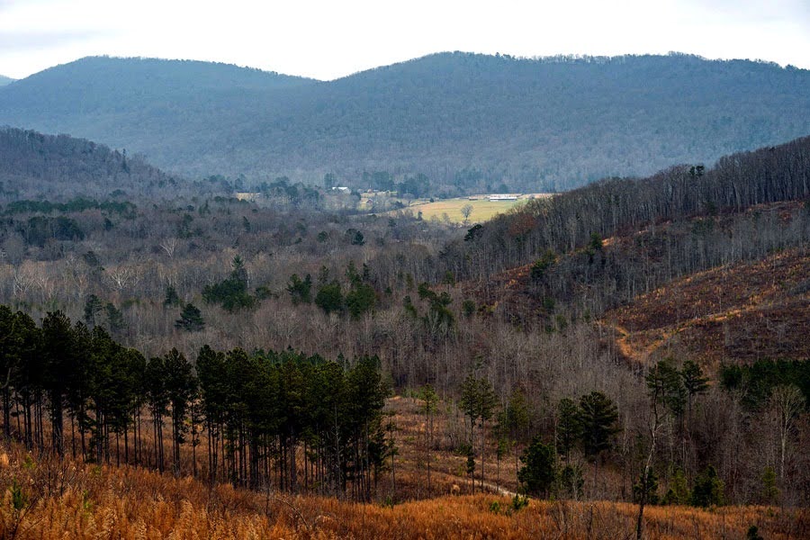
Mile 1.2 (2.7) Cross Brayton Mountain Road then continue to the right of the yellow gate on an old roadbed. A few feet past the yellow gate the trail veers left on a single file track below the roadbed and reaches a boulder with a view looking down on the southern end Cranmore Cove.
Mile 1.6 (2.3) The trail descends below the roadbed and steps over a few wet weather drainages. The trail steps over three more drainages just before intersecting the roadbed again at 1.6 miles. Bear left and downhill on the roadbed.
Mile 1.8 (2.1) At 1.8 miles the roadbed veers left. Bear right on the single file trail. This part of the trail is a pleasant stroll through the forest on the way down to McGill Creek, especially in Autumn.
Mile 2.2 (1.7) The trail continues to descend gradually while alternating between roadbed and single file sections. Reach a triple blaze at 1.9 miles and a second one at 2.1 miles. Step over a small wet weather branch on steppingstones and reach McGill Creek at 2.2 miles.
Mile 2.4 (1.5) The trail veers right and follows the creek upstream with the creek on the left. When the aluminum bridge comes into view ahead the trail veers right and slightly up. It goes above the bridge then curves left and down, reaching the bridge at 2.4 miles. The bridge crosses the creek at a particularly pretty spot, especially upstream to the right.
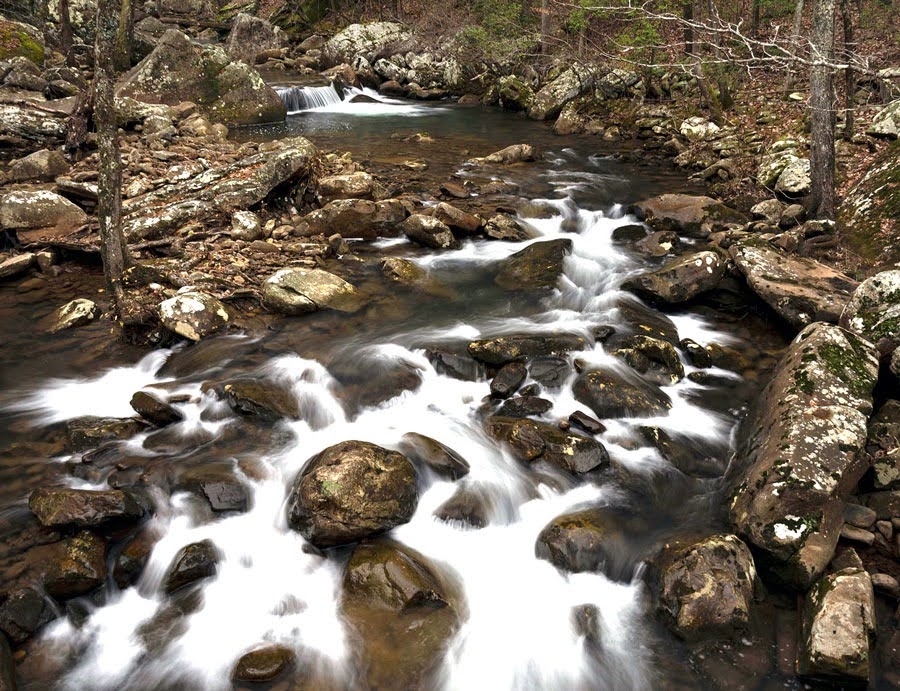
Mile 2.6 (1.3) At the far end of the bridge turn right immediately. The trail goes upstream near the bank a few steps before veering left and uphill on stone steps. This part of the trail between the bridge and McGill Creek Falls goes up and down with the help of numerous stone steps. After climbing up the steps continue on a smooth bench cut before descending back to the creek on another impressive set of stone steps at 2.6 miles.
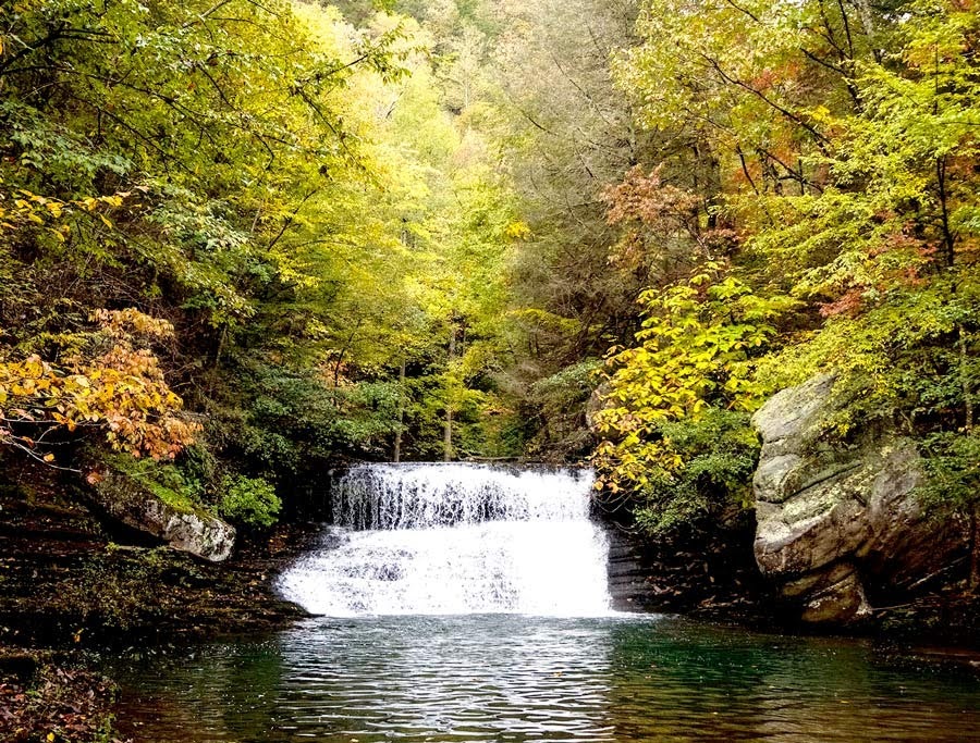
Mile 2.8 (1.1) The trail follows the creek upstream and now on the right. There are several nice spots along this section to stop and admire the creek. At 2.7 miles the trail veers left and up away from the creek on another impressive stone “staircase”. The trail then traverses a boulder field on well-placed stones with numerous white blazes to help stay on course. Foot “chocks” have been cut into one large, flat, and slanted boulder, a particularly nice touch. Reach the junction with the blue-blazed spur trail at 2.8 miles. The spur trail goes down about 200 feet to beautiful McGill Creek Falls. The trail currently ends at the waterfall.