
Laurel Snow SNA
SNA Parking Lot to Hwy 30
Overview
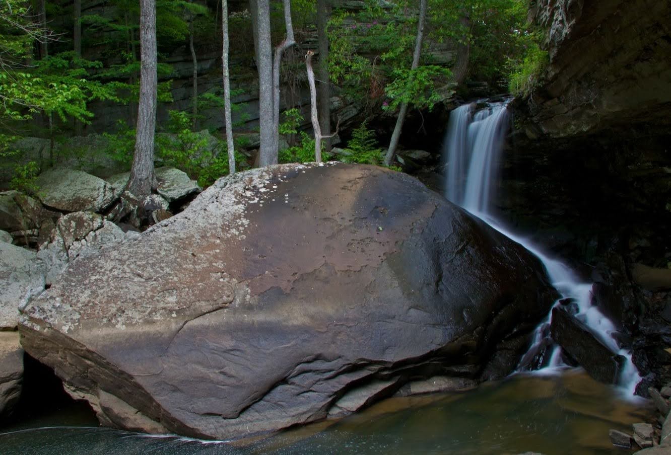
The Laurel-Snow Section contains an area of gorges deeply cut into Walden Ridge of the Cumberland Plateau by Morgan, Henderson, Laurel, and Richland Creeks. The site is named after two scenic waterfalls, Laurel Falls (80 feet) and Snow Falls (35 feet). The area features scenic creeks, steep gorges, geologic features, a small stand of virgin timber, and a wide variety of plants and animals.
In addition to a fascinating day hike, this section is great for setting up a base camp at Mile 1.8 and hiking to Laurel Falls one day and to Snow Falls the other. This trail system currently includes a 5.7 mile section of the main Cumberland Trail with the trails to Laurel Falls and Snow Falls will be officially spur trails off the CT, but well worth visiting.
This trail system is a legacy of the area’s earlier incarnations as the Richland Mine and Bowater property. The trail begins on the old railbed used for hauling coal out of the valley. Later, Bowater, a woodlands and paper company, set aside the area as a “pocket” wilderness and constructed the trails. When Bowater divested itself of most lands in Tennessee, the state acquired the land, a designated state natural area.
Trail Section Details
Features:
- Waterfalls
- Swimming
- Wildflowers
- Fall color
- Bluffs
- Loop/Lollipop
Counties:
- Rhea
Distance:
5.7 miles
Difficulty:
Strenuous
Elevation Change:
Max elevation of 1850 near Hwy 30. Min elevation of 820 at SNA Parking Lot.
Northern Terminus:
None
Southern Terminus:
SNA Parking Lot (N35 31.566 W85 01.310) or Hwy 30 (N35 31.553 W85 02.793)
Timezone:
EDT
Cautions:
Be careful crossing streams and near the tops of waterfalls
Camping:
Henderson Creek Campsite at Mile 1.8, Laurel Creek Campsite 0.9 mile on Laurel Falls spur, and Morgan Creek Campsite 2.4 miles on Snow Falls spur. Registration required.
Topographic Maps:
Morgan Springs Quadrangle
Trailheads
Laurel/Snow SNA Parking Lot
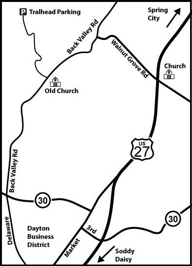
On the northeast end of Dayton on US 27, northeast of Chattanooga, turn northwest on Walnut Grove Road. In 0.7 mile, turn left on Back Valley Road and then in another 0.7 mile turn right at the sign for Laurel-Snow. The trail begins where the road dead-ends in a parking area in 1.0 mile.
Hwy 30 Junction
From Market St. in downtown Dayton, take the Dayton Mountain Highway (Hwy 30) northwest about four miles. Wooden signs mark the trail access on each side of the road but also advise parking along the highway is subject to towing. A grassy clearing behind a guardrail may offer limited space. Be respectful of private driveways.
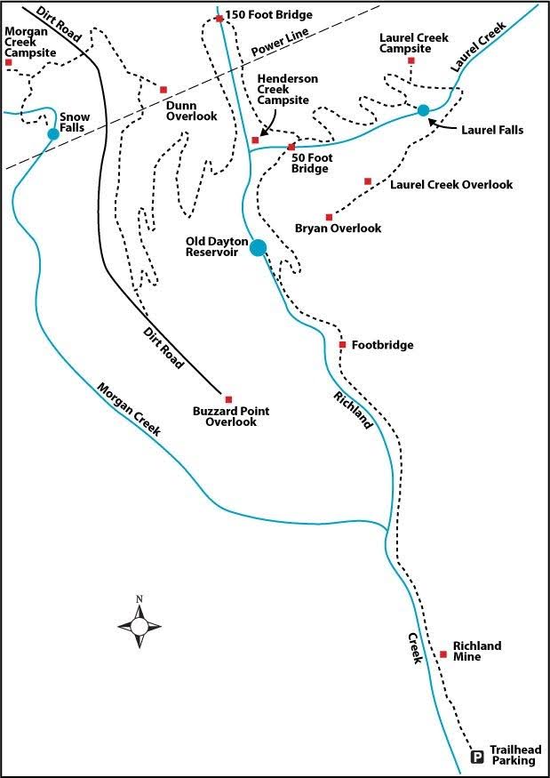
With plans to continue the trail north from the Henderson Creek Bridge, there is currently no Northern Terminus. This trail is described from the original Southern Terminus of the SNA Parking lot to the new Hwy 30 Junction (Alternate Southern Terminus) that connects to the Graysville Mountain section.
Map
Description
South to North (North to South)
Mile 0.0 (5.7) The trail starts off wide and flat as it parallels Richland Creek to your left, following the old railbed.
Mile 0.1 (5.6) A short trail leads uphill to the right to the entrance of Dixon Slope Mine; do not enter.
Mile 0.2 (5.5) The entrance to Richland Mine is on the right. This former coalmine is ungated but again do not enter; the mine is unsafe due to flooding and crumbling infrastructure. Notice the insignia of the mining company painted on the rock, which, unfortunately, has been defaced with graffiti.
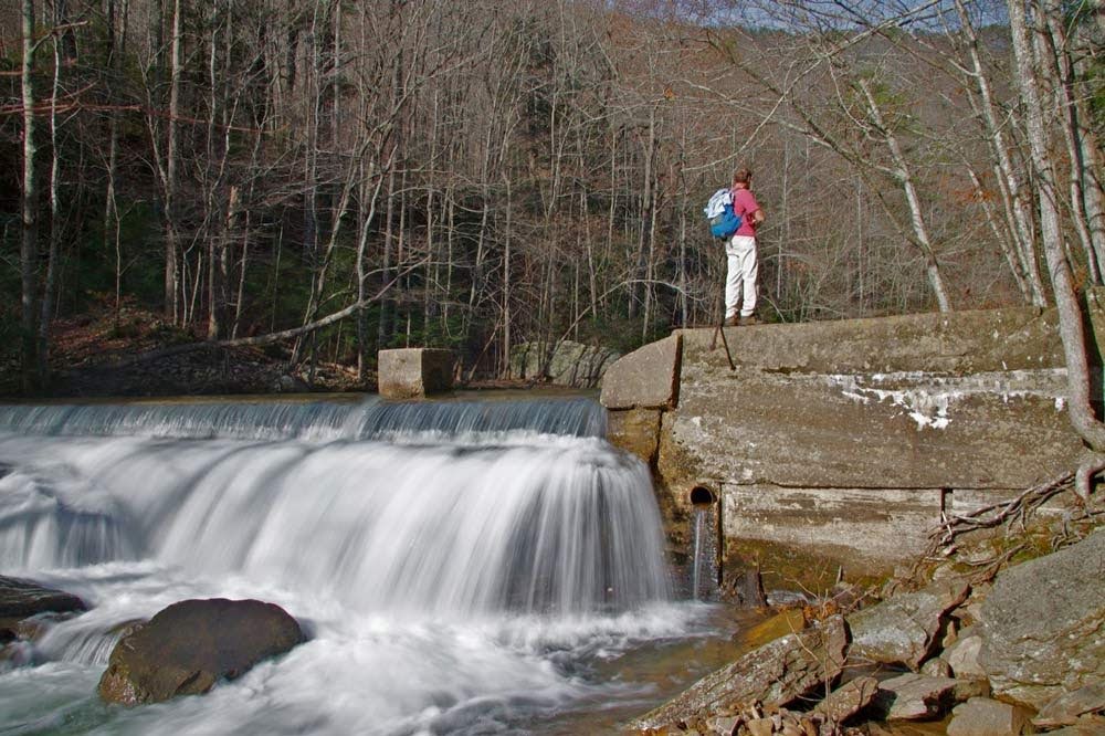
Mile 1.2 (4.5) The trail abruptly narrows and turns right. But here a small path continues straight 400 feet to the Dayton Reservoir that used to supply water to the town of Dayton. The low dam creating the reservoir is still there. On the main trail, take the right turn and head uphill.
Mile 1.7 (4.0) After crossing a metal bridge over Laurel Creek, the trail forks, with the right fork leading to Laurel Falls and the left fork leading to Snow Falls. To follow the main route of the CT, take the left fork toward Snow Falls.
Mile 1.8 (3.9) A short path on the left leads to Henderson Creek Campsite near the intersection of Henderson and Laurel Creeks, which combine to form Richland Creek.
Mile 2.0 (3.7) The trail crosses under power lines.
Mile 2.1 (3.6) A 150-foot bridge spans Henderson Creek, which is rather enthusiastic at this point. It’s a good idea to use the cables for handholds, especially in winter.
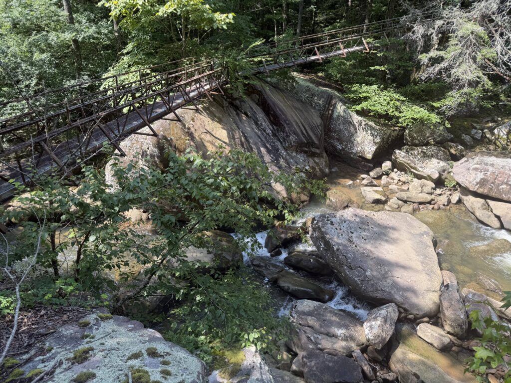
Mile 2.3 (3.4) As you continue along Henderson Creek (now going the opposite direction), the convergence with Laurel Creek and the waters from Laurel Falls are now on your left.
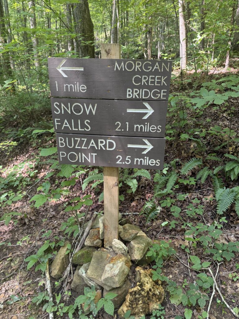
Mile 2.5 (3.2) The intersection of side trails leading to Buzzard Point and Snow Falls are marked with a sign on the right (Distances seem to be inverted on the sign as Snow Falls tracks slightly farther away). Trail continues for about one mile on an easy descent to Morgan Creek.
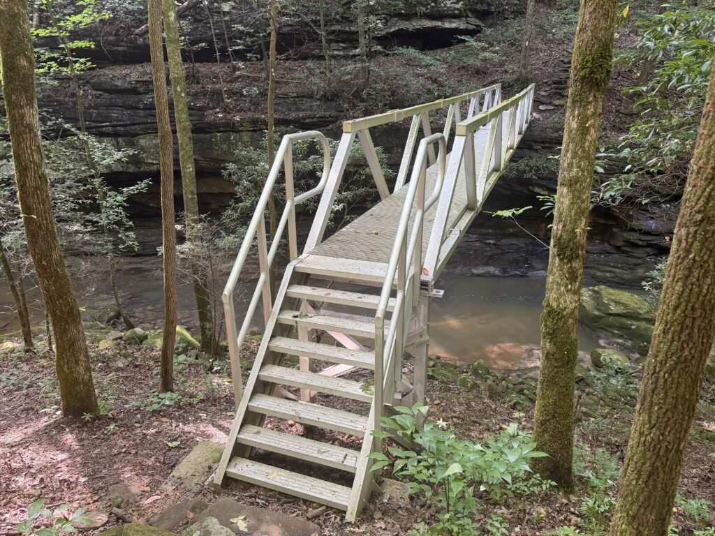
Mile 3.6 (2.1) Arrive at a metal bridge crossing Morgan Creek. These waters eventually make their way to Snow Falls. Turn right off the bridge, then uphill to the left, then another right as the trail takes the path of an old mining road. More evidence of old mining caves can be seen as you travel along the south side of the creek for the next quarter mile.
Mile 3.9 (1.8) Trail turns left away from the creek and will climb over some rock steps gaining 200 feet of elevation over the next quarter mile before arriving at a rock bluff. Use this as a resting point after the climb from the creek; have a snack and some water.
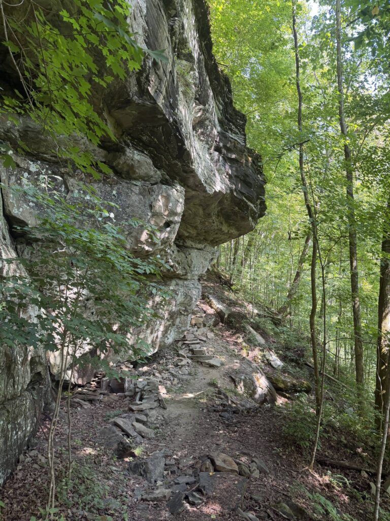
Mile 4.1 (1.6) The trail leaving the rock bluff and headed toward Highway 30 over the next .5 mile is arguably the most difficult, both in terms of hiking and trail-building, along the entire Cumberland Trail. The rock steps are well-placed and the terrain is safe, but the climb gains almost 600 feet of elevation in that span. Though this Laurel/Snow segment of the CT is only 5.7 miles, this stretch mandates the “strenuous” rating.
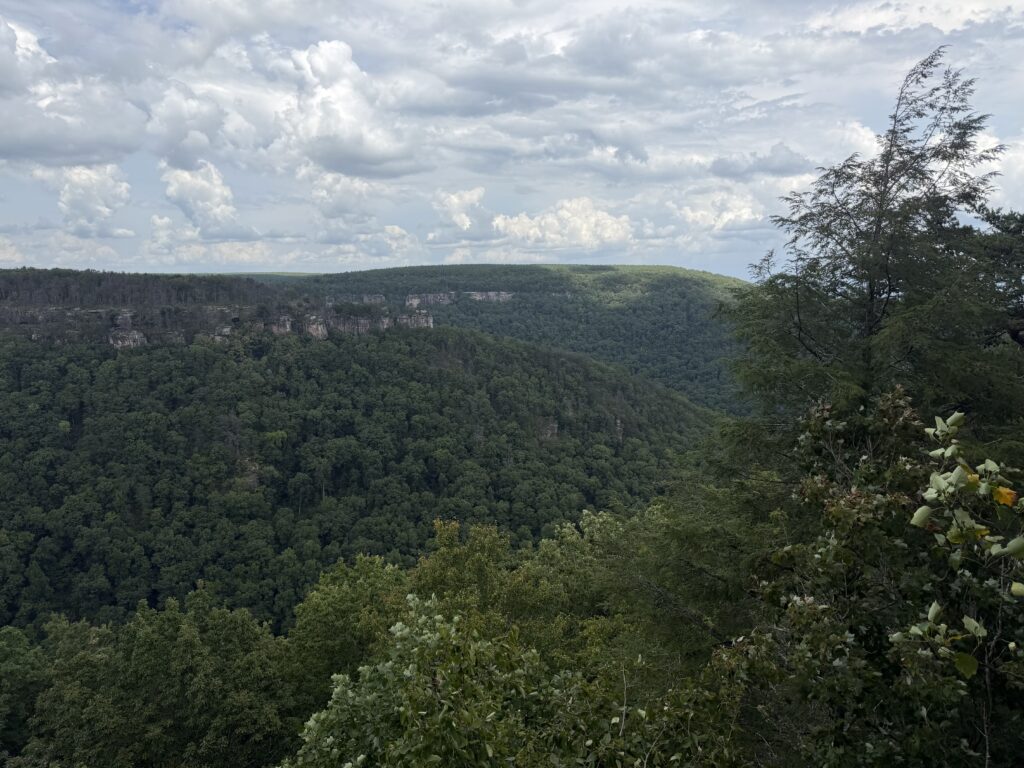
Mile 4.6 (1.1) The payoff after a tough climb is usually a great overlook, and this view above Morgan Creek, known as North Pole Gulf, with a view across to Buzzard Point does not disappoint.
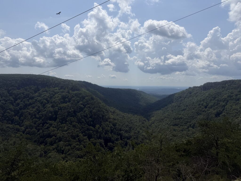
Mile 4.8 (0.9) Pass through a clearing with powerlines overhead.
Mile 5.1 (0.6) Evidence of cleared land, a barn, and barb wire fencing indicate proximity to the highway. The trail is flat and easy in this area and remember to be respectful of private property.
Mile 5.6 (0.1) The final stretch of trail passes through some large, exposed boulders. Prior to the construction of the modern Highway 30, the original Dayton Mountain Highway required early automobiles to pass through some of these, and it became known as “The Narrows”. A wooden ladder serves to assist with your final descent.
Mile 5.7 (0.0) Arrive at Highway 30 and the conclusion of this segment. The Cumberland Trail continues behind the guardrail on the opposite side of the highway. That is the Graysville Mountain segment going south toward Gilbreath Creek Bridge.
Long-range plans call for the CT to continue north from the 150-foot bridge via the Henderson and Hazelnut Creek watersheds to Liberty Hill Road. The exact route of ~5 miles is still to be determined. A trailhead on Liberty Hill Road will also mark the beginning of the Uplands Section, which will travel ~5 miles northeast to Wash Pelfrey Road; route yet to be determined.
Laurel Falls Spur Trail (from trailhead, 3.3 miles one-way to end of trail)
Mile 0.0 (1.6) Split from the main trail at Mile 1.7, taking the right fork. The trail continues to gain significant elevation.
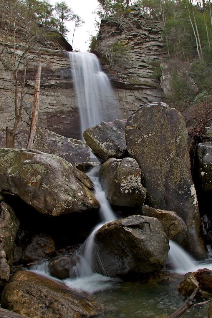
Mile 0.7 (0.9) Reach the foot of Laurel Falls. Except in the dry peak of summer, the 80-foot waterfall is an impressive sight. The trail continues to the left of the falls and becomes markedly more steep and rugged until it tops the plateau.
Mile 1.1 (0.5) The trail fords Laurel Creek not far from the top of the falls to the right. Use caution in crossing; it may be impassable in high water.
Mile 1.5 (0.1) Laurel Creek Overlook to the right offers a view of Laurel Creek Gorge below.
Mile 1.6 (0.0) Reach Bryan Overlook, named for William Jennings Bryan, prosecutor in nearby Dayton’s Scopes Monkey Trial. On some maps, this is known as Raven Point. With either name, it offers a nice view east from the rim of the Cumberland Plateau. There is no more trail from the overlook, so you’ll retrace your steps back to the junction with the main trail at Mile 1.7 and return to the trailhead or continue north on the CT to the 150-foot bridge if you’re headed to Snow Falls.
Snow Falls Spur Trail (from trailhead, 4.8 miles one-way to end of trail)
Mile 0.0 (2.7) After crossing the 150-foot bridge over Richland Creek at Mile 2.1, continue on the spur trail toward Snow Falls.
Mile 0.2 (2.5) The trail crosses back under power lines and soon begins a long uphill climb.
Mile 1.4 (1.3) Reach a junction at the top of the ridge. The left fork quickly reaches a dirt road where you turn left for 0.4 mile to reach Buzzard Point, a spectacular view of the Valley of East Tennessee that lies between the Cumberland Plateau and the Great Smoky Mountains. After the view, walk back along the dirt road to the short trail down to the junction. If you stay on the road, it will eventually rejoin the main trail, but it doesn’t cut off any significant distance or elevation gain, and it skips Dunn Overlook; so return on the path to the junction and take the right fork. (Or you can make a loop by staying on the road and catching Dunn Overlook on your return.)
Mile 1.9 (0.8) Pass under the power lines again.
Mile 2.0 (0.7) A short side trail to the right leads to Dunn Overlook of the Henderson, Laurel, Richland Creek Gorges.
Mile 2.2 (0.5) Cross the old road leading left to Buzzard Point in 1.4 miles.
Mile 2.4 (0.3) A side path to the right leads to Morgan Creek Campsite.
Mile 2.6 (0.1) The trail fords Morgan Creek, which is wide but usually shallow. In times of high water, use caution in crossing, especially with ice in winter. After the crossing, the trail briefly heads right before an easy-to-miss left turn takes the trail away from the edge of the creek.
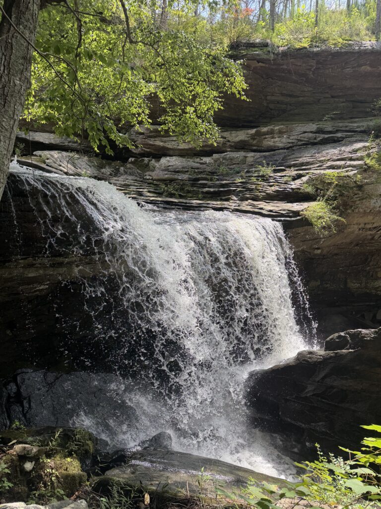
Mile 2.7 (0.0) The trail spreads out into several paths, but they all lead toward the falls. The view of 35-foot Snow Falls from above is underwhelming, but it is possible to scramble to the base of the falls for a better view as the water two-steps into the plunge pool.
More Information
Hiking Laurel-Snow Pocket Wilderness, Dayton, TN
Special Note On Access Hours:
Laurel-Snow State Natural Area
Open: 8am – 7pm Eastern
Vehicles left in gated areas after sunset are subject to being towed or locked in. Overnight parking is allowed by permit at designated trailheads only.
Overnight camping permits are handled through the Friends of the Cumberland Trail Site.
Laurel-Snow Topo Map and GPS Waypoints
The following detailed topographic maps of the trail were created using TOPO! 2009 National Geographic found at National Geographic Topo Explorer.
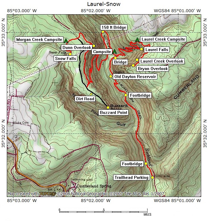
| Location | Waypoint in WGS84 Format |
|---|---|
| Trailhead | N35 31.595 W85 01.311 |
| Richland Mine | N35 31.767 W85 01.392 |
| 50 Foot Bridge | N35 33.001 W85 01.912 |
| Laurel Falls | N35 32.841 W85 01.450 |
| 150 Foot Bridge | N35 33.001 W85 01.912 |
| Snow Falls | N35 32.792 W85 02.312 |
| Buzzard Point | N35 32.263 W85 01.849 |
| Henderson Creek Camp | N35 32.815 W85 01.824 |
| Laurel Creek Camp | N35 32.942 W85 01.529 |
| Morgan Creek Camp | N35 32.907 W85 02.366 |
| Dunn Overlook | N35 32.865 W85 02.023 |
| Laurel Creek Overlook | N35 32.662 W85 01.527 |
| Bryan Overlook | N35 32.629 W85 01.625 |
| Old Dayton Reservoir | N35 32.560 W85 01.826 |
Richland Mine and the Dayton Reservoir
A hundred years ago, this land was used to supply water and power rather than recreation. The Dayton Reservoir used to supply water to the town of Dayton, and the Richland and Dixon Slope Mines were dug for coal.
The Richland Mine entrance to the right of the trail is hard to miss. Although it’s tempting to go inside, abandoned mines are notoriously unsafe, and this one is filled with water a short way in.
The Dixon Slope Mine entrance is off the trail a short distance. Nearby Nelson Mine, on private property, was also owned by the Dayton Coal & Iron Company.
The heyday of coal mining in the area occurred in the 1880s and 1890s. The Nelson Mine in particular was a dangerous site—an 1889 gas explosion killed 4 men; another in 1895 killed 28; and yet another in 1902 killed 16.
The Dixon Slope Mine never actually struck coal. The newest of the three mines, it was dug under Richland Creek to access the coal seam that the Nelson Mine had found before being flooded. However, in 1913 the company went into bankruptcy. It turns out the Dixon Slope Mine was only 20 feet away from the coal seam. The coal and iron company also produced coke here for use in making iron.
From trailhead parking, you can walk south along the creek to the long lines of coke ovens; if not cleared recently, they may be overgrown. Recently, archeological work has been done in the area to better understand its history and to possibly apply to have the site added to the National Register of Historic Places.
— EP
Last Update: 10/07/26 by Ron Hees