Devil’s Breakfast Table
Devil’s Breakfast Table to Peavine Rd
Overview
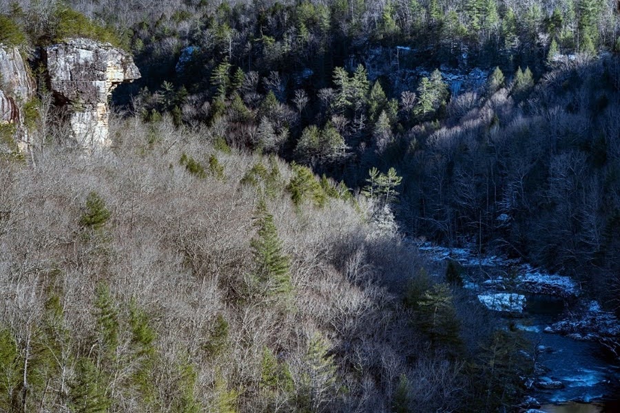
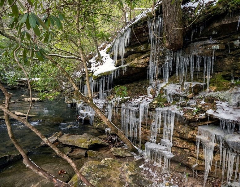
This trail is 7.6 miles one way and travels much of the way on the bluff top above Daddys Creek. The trail dips down to the creek at the halfway point. A backcountry campsite is beside the trail just above the creek. The trail climbs back to the top of the bluff after leaving the creek and campsite. It then passes three short spur trails to beautiful overlooks of the Daddys Creek gorge. The trail drops down to Little Cove Branch next to an impressive rockhouse bluff and bridges the branch on an aluminum bridge. The trail then climbs out of the cove to a ridge before dropping down and crossing Sulphur Springs Branch on a wooden bridge before climbing to the northern terminus trailhead.
The Northern terminus of this Section connects to the Southern terminus of the Obed River Wild and Scenic River Segment on Firetower Road at Devil’s Breakfast Table (N36°03.523 W84°47.548).
Time Travel Alert: Be aware that the northern trailhead is on the boundary with Eastern Time Zone at Devil’s Breakfast Table. Hikers relying on cell phones are libel to pick up signals from towers in both time zones. Carry a conventional watch.
Hikers Caution
Observe hunting calendar before hiking in Catoosa WMA. According to the 2016-2017 TWRA Hunting Guide, page 56, Catoosa WMA is now open year-round for through hiking on the Cumberland Trail. This is a significant change from previous policy. However, hikers may not drive into the Catoosa WMA during hunting days. Access on hunting days is only by the current trailhead at Nemo Bridge.
Hikers must wear florescent clothing to maintain visibility to hunters in the area during hunting seasons.
Hunting Seasons: In general, hunting dates follow this schedule: Mid-October through December various long weekends (Fri – Sun) February and March for all users (roads are gated, not allowing motorized vehicles). And April to first week of May, on most days. Hikers may NOT drive into Devil’s Breakfast Table trailhead during any hunting day.
For specific hunting dates in Catoosa WMA, contact the Region III WMA Office at 1-800-262-6704. or download the Hunters guide from the TWRA website HERE.
Trail Section Details
Features:
- Waterfalls
- Overlooks
- Swimming
- Wildflowers
- Fall color
- Bluffs
Counties:
- Cumberland
Distance:
7.6 miles
Difficulty:
Moderate
Elevation Change:
1500 feet gain south to north, 1900 feet north to south
Northern Terminus:
Daddy’s Creek Trailhead on Firetower Road at Devil’s Breakfast Table (El. 1,266′ N36°03.523 W84°47.548) (Trailhead is on border with Central and Eastern Time Zones)
Southern Terminus:
Peavine Road near Antioch Bridge. (El. 1642′ 36.°00′ 2.75″W 84°49’30.31W)
Timezone:
EDT
Cautions:
Steep bluffs at overlooks. See Hikers Caution below.
Camping:
North Peavine Campsite 3.8 miles from each trailhead
Topographic Maps:
Hebbertsburg and Lancing Quadrangles
Trailheads
The Devil’s Breakfast Table Trailhead represents the Southern terminus of the Obed Wild and Scenic River Segment. It is the Northern terminus of the Crab Orchard Mountain Segment.
As a reminder, as of 2019, the CT is divided into 12 SEGMENTS. There are 25 SECTIONS. Each segment may have several or the segment may stand alone. Please explore the trail segment menu.
The Northern Trailhead
The northern end of this Section can be reached by entering the Catoosa WMA on Firetower Road. Take I-40 Exit 322, go north on Peavine Road/101 North for 1.8 miles to Firetower Road. Turn left on Firetower Road where you will see the high voltage power lines on your left. Firetower Road is a paved road for 3.5 miles and then becomes packed gravel when you approach the Catoosa WMA entry. The main roads in the Catoosa are graveled but suitable for passenger cars. Proceed another 11 miles after entering the WMA to Daddys Creek and the Devil’s Breakfast Table. (Note: Fire Tower Road turns into Otter Creek Road shortly after entering Catoosa WMA). Cross a sturdy 120-foot one-lane bridge with wood decking and no guardrails over Daddys Creek. Graveled parking is on the right with room for about a dozen vehicles at Devil’s Breakfast Table trailhead. (Note: Fire Tower/Otter Creek Road becomes Hebbertsburg Road after crossing the bridge over Daddys Creek.)
Devil’s Breakfast Table trailhead can also be reached from I-40 Exit 329 in Crab Orchard. Take I-40 Exit 329, go north. Cross TN 70 and a railroad. Turn left at the gas station on Main Street. Proceed three streets to Hebbertsburg Road. Turn right. Drive 5.3 miles north to a T intersection and a stop sign. (Note the Daddys Creek trail head sign on the left at about 3 miles.)
Turn right at the T intersection onto Peavine road. Antioch Cemetery is on the left. Proceed .4 miles on Peavine Road to a fork on the road. Take the left fork. Proceed .6 miles and take the left fork again. Continue another .6 miles on an asphalt road. Enter Catoosa Wildlife Management Area and the road becomes packed gravel. In 3.4 miles arrive at the first intersection and turn left. Proceed 2.6 miles to Daddys Creek. Just before the bridge is a parking area on the left.
Devils Breakfast Table Trailhead. Trailhead for the Obed Wild and Scenic River Segment is about 200 feet up the gravel road east of Daddys Creek bridge on the left. The trail with two big boulders across from the parking area is not the CT. This area is also popular with people swimming and fishing during the summer months.
The Southern Trailhead
36.000824, –84.825522
The Southern terminus can be reached from Exit 322 on I-40.
Take Peavine Road north toward Fairfield Glade. Travel 6 miles to a four way stop in the middle of Fairfield Glade. The trailhead is exactly 4 miles from the four way stop on the left. There is room to park about four vehicles on the shoulder on the south side of the road directly across from the trailhead.
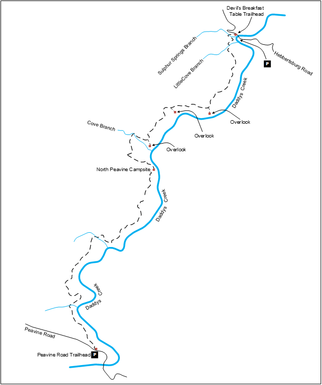
Map
Description
South to North (North to South)
Mile 0.0 (7.6) Start at the trailhead kiosk on the north side of Peavine road. The kiosk provides a nice topo map of the trail. The trail starts along the bluff top on fairly level and smooth terrain through hardwoods.
Mile 0.7 (6.9) Cross an unnamed branch on a wooden bridge.
Mile 1.2 (6.4) The trail crosses a roadbed. Large arrowed blazes direct you straight across the roadbed.
Mile 2.1 (5.5) Cross another unnamed branch on a wooden bridge.
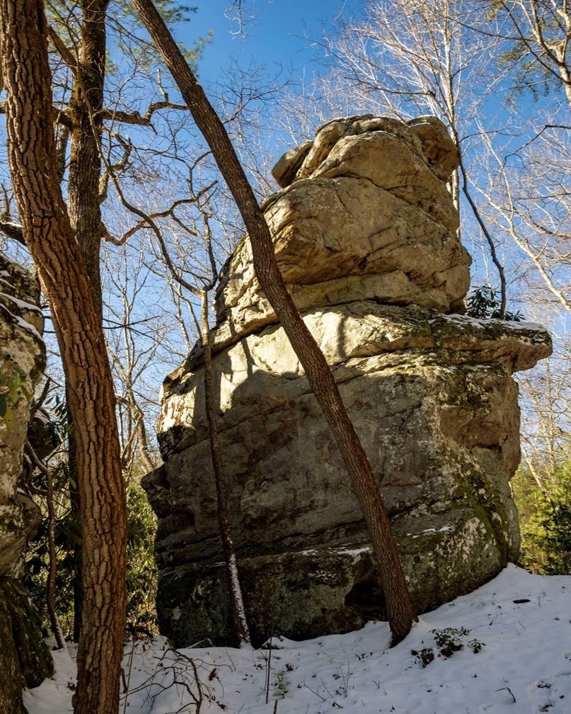
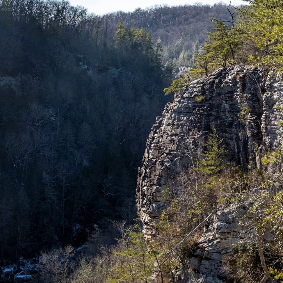
Mile 2.3 (5.3) Reach an interesting rock formation.
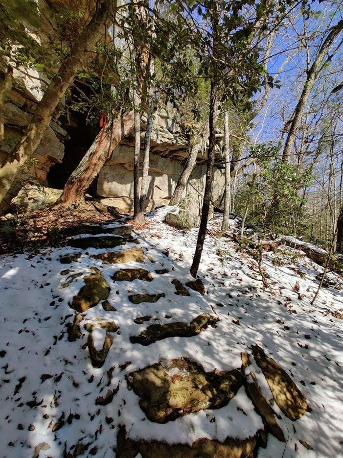
Mile 2.9 (4.7) The trail climbs slightly on stone steps reach a rock bluff and the trail continues at the base of the bluff.
Mile 3.2 (4.4) Step over a wet weather drainage on well-placed stones.
Mile 3.5 (4.1) Begin the descent to Peavine North campsite and Daddy’s Creek on a set of well graded switchbacks.
Mile 3.8 (3.8) Reach Peavine North campsite which is well situated on a flat area just above Daddy’s Creek. The campsite is exactly half way along the trail.
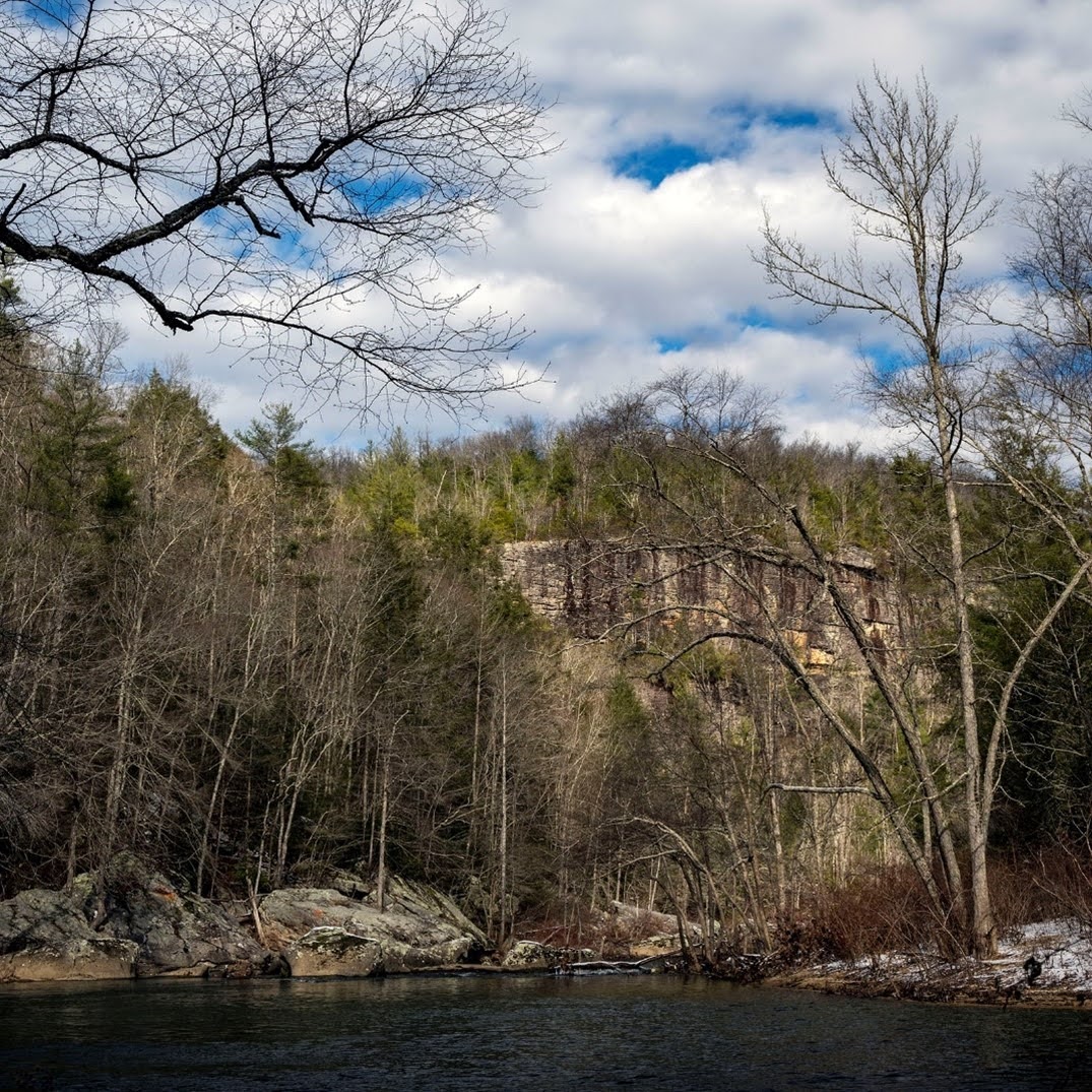
Mile 3.9 (3.7) Reach Daddy’s Creek just past the campsite. Stop to enjoy the impressive view up and downstream and directly across the creek. Then begin the climb back to top of bluff, again on well graded switchbacks with strategically placed stone steps.
Mile 4.7 (2.9) Step across Cove Branch on steppingstones. This crossing is very picturesque and well worth stopping to enjoy for a moment or two.
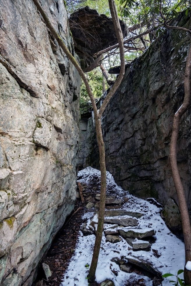
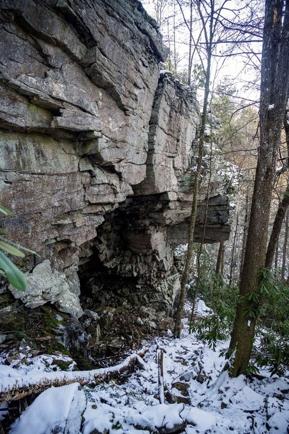
Just past the branch crossing the trail descends on steps through a nice “stone door” with an overhanging rock roof.
Mile 4.9 (2.7) Reach an unsigned junction to an obvious use trail on the right. The use trail leads 0.1 miles to an excellent overlook of three rapids on Daddys Creek below. The 0.2 miles round trip to the overlook is not included in the trail mileage.
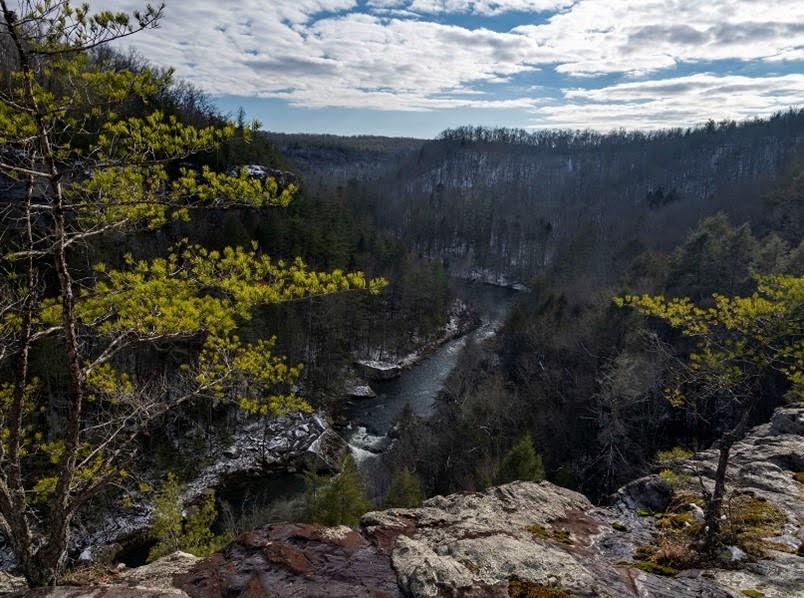
Mile 5.5 (2.1) Return to the main trail and reach a spur trail junction signed Overlook pointing right. A short 0.1-mile round trip takes you to another nice overlook with views of a distinctive “beak bluff”. The 0.1-mile round trip to the overlook is not included in the trail mileage.
Mile 6.1 (1.5) Reach an unsigned junction to an unsigned use trail on the right. A short 0.1-mile round trip takes you to another nice overlook with views of a distinctive “bowed bluff”. The 0.1-mile round trip to the overlook is not included in the trail mileage.
Mile 6.3 (1.3) Just past the overlook step over a wet weather branch and then another at 6.3 miles.
Mile 6.7 (0.9) Reach a trailside “stone bench”.
Mile 7.0 (0.6) Begin a steep descent to Little Cove Branch side gorge next to an impressive rock formation. Marvel at the stone steps constructed by the Cumberland Trails Conference crew.
Mile 7.1 (0.5) Bridge Little Cove Branch on an aluminum bridge then begin climbing out of the side gorge.
Mile 7.2 (0.4) Reach the ridgetop after climbing out on the side gorge and begin descending along the ridgeline.
Mile 7.4 (0.2) Bridge Sulphur Springs Branch on a wooden bridge and begin the final short climb to the north trailhead.
Mile 7.6 (0.0) Reach the northern trailhead on gravel Otter Creek Road. The road descends and bridges Daddys Creek at Devil’s Breakfast Table about 0.2 miles below the trailhead. The road name changes to Hebbertsburg Road after crossing the bridge. There is a large parking area after crossing the bridge to the south bank of Daddys Creek.