
Tennessee Valley Divide (North)
Carr Gap to Wilson Gap
Overview
The Cumberland Trail from Wilson Gap to Carr Gap follows the ridgeline of Cumberland Mountain, offering dramatic contrasts between coal mines on the western horizon and farms and pastureland stretching across Powell Valley to the east. On clear days, hikers can see Clinch Mountain and even the distant Great Smoky Mountains, with the valley views becoming especially striking from late fall through early spring, though summer still provides scenic overlooks at occasional clearings and rock outcrops. After the initial climb to the ridge, the most difficult section is behind you, as the remainder of the route features the gentler ups and downs typical of ridge hiking rather than the steep, rocky ascent from the valley below. The trail itself is wide, clearly identifiable, commonly used by ATVs, and marked in places with orange TDEC boundary markers indicating the public right-of-way.
Trail Section Details
Features:
- Overlooks
- Wildflowers
- Fall color
Counties:
- Claiborne
Distance:
7.8 miles
Difficulty:
Moderate
Elevation Change:
1000 feet
Northern Terminus:
Carr Gap (N36 30.706 W083 49.711)
Southern Terminus:
Wilson Gap (N36 28.837 W083 53.996)
Timezone:
EST
Cautions:
This trail section is currently inaccessible from its historic trailheads.
Camping:
No designated campsites
Topographic Maps:
Well Spring, Ausmus, and Fork Ridge Quadrangles
Trailheads
There is currently no public access to the Tennessee Valley Divide (North) section at either terminus.
- The former Wilson Gap access is no longer available.
- Chumley Mountain Road cannot be used because it crosses private property.
- Parking is not permitted on Carr Gap Road.
The nearest public access point is the Sarvis Road Trailhead. However, the trail segment between Sarvis Road and Wilson Gap is currently closed, preventing through access to the Tennessee Valley Divide (North) section.
Map
Description
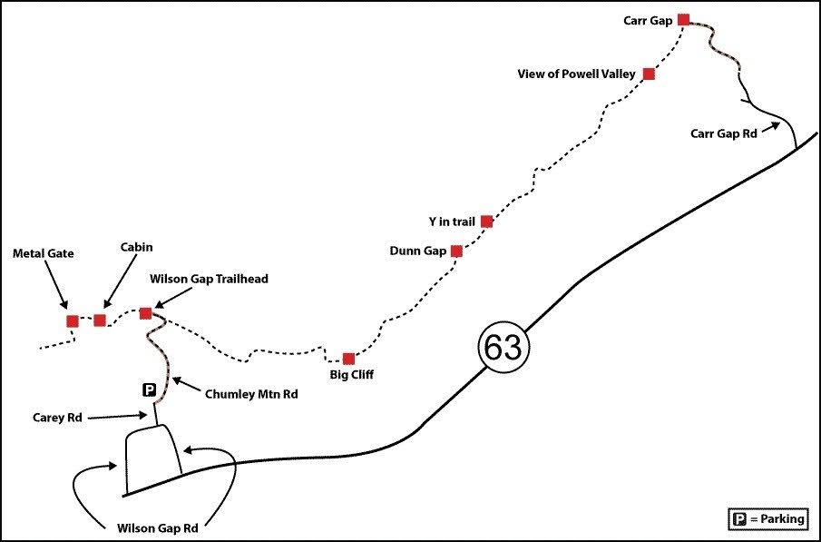
Mile 0.0 (7.8) Head up Chumley Mountain Road, which is moderately steep and very rocky after the cemetery.
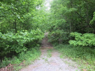
Headed toward Wilson Gap (Sharon Petro)Mile 1.2 (6.6) Reaching Wilson Gap, you’ll have a view of the coal mining areas around Tackett Creek and Clairfield to the northwest and the view of Powell Valley to the southeast. The gap is easily identifiable, as there is an ATV trail running through the gap that follows the Cumberland Mountain ridgeline. Take the ATV trail to your right, heading in a generally northeasterly direction.
Mile 1.4 (6.4) After hiking 300 to 400 yards, you’ll see the skeletal remnants of a cabin adjacent to the trail. Depending on the time of year you’re hiking, beautiful ferns and mountain laurel can be found another few hundred yards past the old cabin.
Mile 2.7 (5.1) Big Cliff (N36 28.307 W083 52.610), a rocky outcrop on the eastern face of the ridge, provides a stunning vista of Powell Valley below and the various mountain ridges to the northeast. To the southeast, you can also see various coves with the deep blue waters of Norris Lake. Just below the cliff is a dirt road coming up to Rogers Gap from the valley below. This road provides access to the radio tower that you’ll notice a few hundred yards north of Big Cliff. This is one of our favorite spots on this hike and would make a wonderful campsite for an overnight stay; Leave No Trace (LNT) camping practices should be used.
Shortly after departing Big Cliff, you’ll encounter the radio tower and a number of dirt roads in the area. Stay on the western side of the tower and associated buildings. The terrain will take you that direction, and the trail is in good shape. There has been some logging in the area, so be on the lookout for any active logging. The trail and the ridge take more of a northwestern trek after departing Big Cliff.
Past the radio tower, you begin to descend into Rogers Gap. There are many stories about union soldiers traveling to and from Cumberland Gap and crossing through Rogers Gap and the Tackett Creek area.
Mile 3.7 (4.1) After descending into Rogers Gap, the trail advances up the other side with a steady slope. Pass a trail to the right that descends into the valley below. Within a few hundred yards there is a Y in the trail; stay to the right (northeast).
Mile 4.6 (3.2) The next significant terrain feature is Dunn Gap (N36 29.074 W083 51.678), which is 0.9 mile from Rogers Gap. The Gap is only a few hundred yards wide and the trail quickly starts back up the other side.
After leaving Dunn Gap, you will again encounter a Y in the trail (N36 29.276 W083 51.421). This time go to the left (northwest) to avoid private property. The trail is not well marked here, with quite a bit of traffic going both right and left. The right fork descends a hill to a private residence on the cliff overlooking the valley.
Continue along the ridge; you’ll find numerous large oaks and hickories along the trail. While you have temporarily lost the view of the valley, you are in a deep forest with lots of wildlife. Don’t be surprised if you come across deer, turkey, or even a bear or elk.
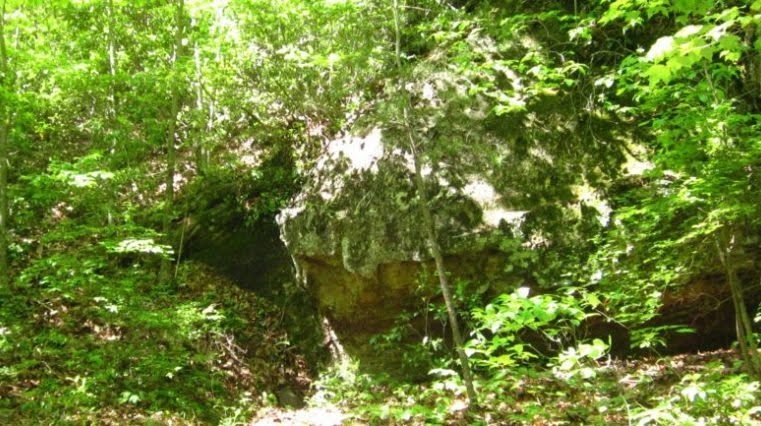
Mile 5.7 (2.1) There is a very large rock and a number of huge oak trees. The rock makes a good resting place with a number of great places to stretch or take a quick nap.
Mile 6.2 (1.6) You will encounter a spring in a depression with steep walls on three sides. Although the water appears to be good, you should treat all water in the backcountry.
Mile 6.3 (1.5) The trail will be back along the ridge with an excellent view of Powell Valley (N36 30.325 W083 50.017). You are getting close to Carr Gap, and if you look toward the northeast you should see the TN 63 and the Carr Gap Road intersection.
The remainder of the trail is along the ridgeline with great views and lots of sunshine on a clear day; however, the trail runs along a heavily used ATV trail. If you are hiking on a weekend and the weather is good, count on seeing, or at least hearing, numerous ATVs in the area.
Mile 7.4 (0.4) You’ll come to Carr Gap (N36 30.706 W083 49.711) and Carr Gap Road. While most of the road is dirt and can only be accessed via ATV, it is a Claiborne County road. Turn right to descend Carr Gap Road, which is very steep and rocky.
Mile 7.8 (0.0) Reach pavement, which is where you would leave a shuttle vehicle. It’s another 0.8 mile out to TN 63.
— Sharon Petro, Ron Petro, Cumberland Trail Volunteers