Soddy Creek Gorge (North)
Heiss Mountain Rd to Sluder Rd TH
Overview
The Soddy Creek Gorge Section of the Cumberland Trail is a dramatic stretch that passes through the Little Soddy Historic Mining Area and crosses three watersheds. The trail passes abandoned mines, offers views of deep valleys and high bluffs, and shows off the impressive work of the volunteers who built this section, including numerous rock steps and wood steps that climb a rock face along Board Camp Creek.
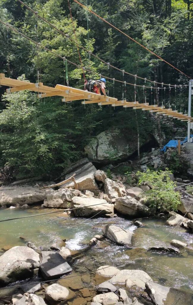
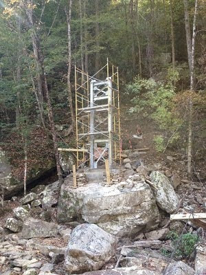
As of November 2015 the temporary bridges on Deep Creek and Big Soddy Creek have been replaced. The 100 foot long suspension bridge over Big Soddy Creek is an impressive feature of this hike. In the area around Deep Creek, you may notice evidence of rock mining that had the potential for destroying the area but which was stopped through efforts of the CTC.
Trail Section Details
Features:
- Waterfalls
- Swimming
- Wildflowers
- Fall color
Counties:
- Hamilton
Distance:
12.1 miles
Difficulty:
Strenuous
Elevation Change:
Estimated uphill: 1200 feet; net elevation change: 100 feet
Northern Terminus:
Heiss Mountain Road Trailhead: N35 20.754 W85 10.501
Southern Terminus:
Hotwater Road/Little Soddy Trailhead: N35 16.897 W85 11.610; HotwaterRoad Crossing: N35 17.311 W85 10.888
Timezone:
EDT
Cautions:
Old road crossings can make it easy to get off trail in a couple places. In autumn, leaves may require one to pick one’s way over the numerous rock steps near the southern end.
Camping:
No designated campsites, but LNT camping along Board Camp Creek on the northern end; water is readily available with two major creek crossings and from Board Camp Creek.
Topographic Maps:
Soddy Quadrangle
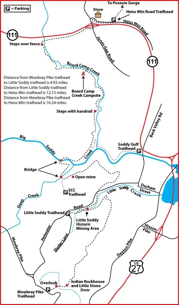
Trailheads
The southern terminus of this section is on Hotwater Road. The CT crosses Hotwater Road, but there’s very little parking there; so this hike begins at the Hotwater Road/Little Soddy Trailhead.
Take US 27 north to TN 319, Hixson Pike Exit, and take a left to the intersection with Dayton Pike. Turn right and go 0.7 mile to Durham Street and turn left. In 0.6 mile, you’ll come to Back Valley Road. Turn right for one block to the intersection with Hotwater Road. Turn left on Hotwater Road.
The parking area is 2 miles up Hotwater Road on the left at the intersection with Sluder Lane. The trailhead is approximately 200 feet back down Hotwater Road on the right side.
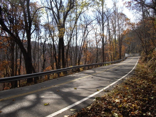
The northern end of this section is on Heiss Mountain Road. From US 27 north of Soddy-Daisy, take TN 111 and ascend the Cumberland Plateau and proceed to the Jones Gap Road exit.
Turn north on Jones Gap Road and immediately turn right onto Heiss Mountain Road, a paved dead-end road that parallels TN 111; you’ll see a small store at the turn.
Parking is along the road about 0.5 from the store. The sign for the Cumberland Trail heading north is near the end of the guardrail, which is the start of the Possum Creek Gorge Section.
Map
Description
South to North (North to South)
Mile 0.0 (12.1) From the Little Soddy Trailhead, walk 200 feet back down Hotwater Road from parking to pick up the blue-blazed connector trail that descends quickly to cross Little Soddy Creek. Signs abound through the Little Soddy Historic Mining Area (BROCHURE) identifying significant sites associated with the coal mining industry that occurred here (Mining History Synopsis).
Mile 0.2 (11.9) Take the yellow-blazed path to the left, which is part of the historic loop. (Straight at the junction will lead another 0.2 mile to connect with the CT where you would bear right to hike the southern part of the Soddy Creek Gorge Section.) Recross Little Soddy Creek and travel along the north side of the creek.
Mile 0.4 (11.7) Junction with the CT coming from the south. Bear left to head north on the CT.
Mile 1.0 (11.1) The trail climbs steeply out of the valley toward Hotwater Road. You may still see old tires that have been dumped from the road if they have not been cleaned up. Fences along the road attempt to keep folks from doing this, but depending their persistence and on when the most recent cleanup occurred, you may see a number of tires along the trail.
The road crossing occurs in a section with the high fence where there is a wooden step to aid hikers in crossing the guardrail. After crossing the road, the trail starts climbing the ridgeline.
Mile 1.5 (10.6) Depending on the time of year, you’ll have a view of the town of Soddy in the valley below as the trail turns north to go around Posey Point.
Mile 1.9 (10.2) The trail rounds Posey Point. TN 111 can be seen far to the north at several points as one walks east along the ridge. You’ll pass through an old pine plantation and begin a gradual descent to pass through a rhododendron thicket.
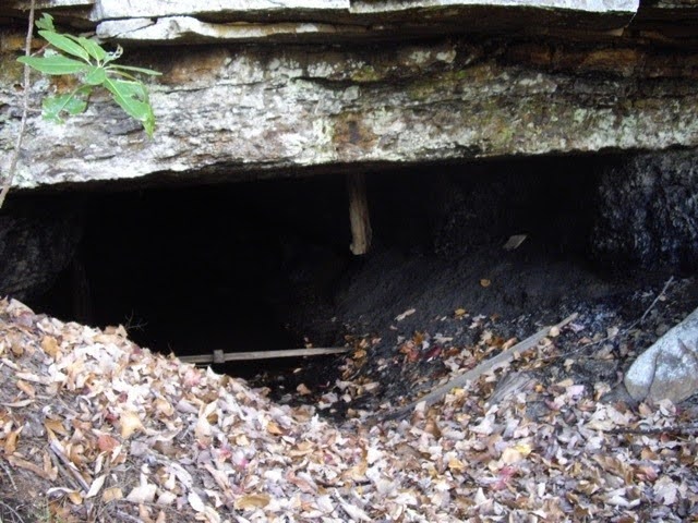
Mile 3.4 (8.7) Pass an old coal mine. Do not attempt to enter.
The trail then becomes a steep, rocky descent toward Deep Creek, a tributary of Big Soddy Creek.
Mile 3.7 (8.4) A climbers’ trail approaches from the left. In 2007, rock climbers became aware of the rock faces on the northern side of Deep Creek up to the confluence of Deep Creek with Big Soddy Creek. This rapidly became a popular climbing area. With concurrence of the state park staff, the Southern Climbing Coalition established parking area off Old Hotwater Road (gated) and built a trail to junction with the CT at this point. http://www.mountainproject.com/v/deep-creek/107162719
Mile 4.0 (8.1) Cross boulder-filled Deep Creek on a new bridge opened in 2015. After crossing Deep Creek, ascend 200 feet as you walk towards the confluence of Deep Creek and Big Soddy Creek. You may notice other trails leading to the bluffs above. High above stand the high rock faces that lure climbers. You can also peer into the valleys below.
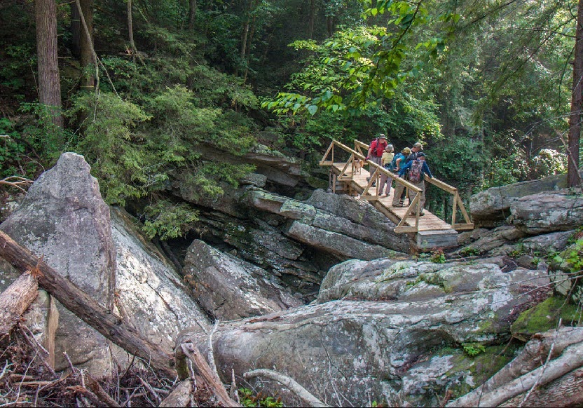
Mile 4.3 (7.8) Past the confluence of Deep Creek with Big Soddy Creek, descend to Big Soddy Creek. The bridge was completed in November 2015. The 100′ suspension bridge is a marvel of back country engineering. The story behind it can be found here. Looking down from the bridge, hikers can appreciate that they no longer have to scramble over the rocks below. It also keeps the trail passable even after a heavy rain. After Big Soddy Creek, you’ll approach the valley of Board Camp Creek.
Mile 5.3 (6.8) Cross an old road as you move up a tributary of Board Camp Creek.
Mile 6.2 (5.9) Reach an unnamed tributary of Board Camp Creek. A back country bridge here had fallen into disrepair and has since been dismantled. The trail was rerouted upstream a short distance to where the stream can now be rock hopped.
Mile 6.9 (5.2) The next major landmark is wooden steps and some low-hanging bluffs approaching them. In building the trail through this section, Cumberland Trail volunteers built a series of steps along a rock face allowing one to climb out of this part of the Board Camp Creek Gorge. You are now headed up Board Camp Creek Valley.
Mile 7.3 (4.8) Cross two wooden bridges and descend gradually to the banks of Board Camp Creek. The trail roughly follows Board Camp Creek from this point. The terrain is fairly flat until you begin an ascent toward TN 111.
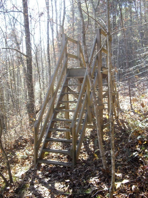
Mile 10.0 (2.1) Gradually ascend to what might be called the “mother” of all stiles, a tall stairway crosses a fence for the TN 111 right of way.
The trail turns right and climbs quickly out of the Board Camp Creek Valley to just behind the tree line on the TN 111 right of way. At this point you are at roughly the same elevation you were at the trail head on Hotwater Road. Surprisingly, you can walk this trail while motorists are unaware of your presence until you exit the tree line near the exit ramp for Jones Gap Road.
Mile 11.6 (0.5) Cross over TN 111 on the Jones Gap Road overpass and take the immediate right onto Heiss Mountain Road.
Mile 12.1 (0.0) Heiss Mountain Road Trail Head.
— Jim Clark, CTC volunteer
More Information
Rock Mining in Soddy Creek Gorge
After a major fund raising effort several years ago, the CTC provided $1.7 million to buy the Rock, Possum, and Soddy Creek Gorges. By 2007, the CTC had spent four years constructing the CT in those watersheds. Volunteers from Tennessee and many other states had provided 50,000 hours of labor to build the trail.
In early 2007, the CTC learned that the section of the Cumberland Trail in the vicinity of the Deep Creek tributary to Soddy Creek was being severely damaged or destroyed by rock harvesting activities. In November 2007, the CTC General Manager at the time asked the CTC Board to help stop the rock removal. The Board contacted TDEC, which at the time was encouraging non-profit groups to sign on to an Amicus Curiae Brief that would introduce and document concerns about rock mining on these lands that had become state property.
In December 2007, the CTC Executive Committee unanimously passed the following motion:
The CTC will sign on to an Amicus Curiae Brief after a positive review of the final language by a lawyer chosen by CTC. Furthermore, the CTC is willing to pay additional expenses for the preparation of the brief up to a $50,000 limit. (cost to the CTC ended up less than $5,000)
By the end of the month, a group of non-profits had agreed to support the Brief, with the CTC was the lead group. The Board took responsibility for legal activities to stop the rock removal. Our lawyers were Greg Buppert from Dodson, Parker, Behm & Capparella in Nashville and Sarah Francisco with the Southern Environmental Law Center.
In April 2008, the Amicus Curiae Brief was filed with the Court of Appeals and was supported by 15 groups:
- Southern Environmental Law Center
- Cumberland Trail Conference
- Sierra Club
- Tennessee Citizens for Wilderness Planning
- Save Our Cumberland Mountains
- American Hiking Society
- Cherokee Forest Voices
- The Land Trust for Tennessee
- National Parks Conservation Association
- The Nature Conservancy
- Obed Watershed Community Association
- Tennessee Clean Water Network
- Tennessee Forests Council Project
- Tennessee Parks and Greenways Foundation
- Tennessee River Gorge Trust
In June 2008, the case was heard by the Court of Appeals. The CTC lawyers were encouraged by the questions and comments from the three Tennessee Appeals Court judges charged with deciding the case.
On July 31, 2008, the Appeals Court gave their opinion. Greg Buppert reported to the CTC:
As you know, the opinion of the court of appeals did not stop the mining company’s rock excavation in the park, but it did provide a clear statement of the basic principle of law that the owner of the mineral rights cannot destroy the surface unless the deeds expressly create that right. The court remanded the case to the trial court for additional proceedings consistent with its opinion, and the principle issue that now needs to be resolved is whether the company is destroying the surface of the park. There may be enough evidence already in the record to support a motion for summary judgment on this issue; otherwise, new evidence will need to be offered at a trial.
The Tennessee rules give the company sixty days to determine whether or not it will appeal the decision of the court of appeals to the Tennessee Supreme Court. If the company appeals, rock excavation will likely continue pending the resolution of the appellate process. If the company does not appeal, the case is activated in the Hamilton County chancery court on the 64th day after the issuance of the July 31 opinion.
Once the case returns to the chancery court, the amici likely have the option to file a motion requesting to be interveners in the case. We should expect that the company will challenge any attempt by the amici to join the case, and we cannot predict whether or not the trial judge will be agreeable to our participation. However, intervening would likely give the amici the greatest ability to direct the action in this case, an option that should be given careful consideration. If you decided not to move to intervene, and depending on how the attorney general proceeds with the case, there may also be an opportunity to file another amicus brief.
The attorney general’s office has not indicated how it plans to proceed if the case does go back to the chancery court in October. Various sources at the state have indicated that they are waiting out the 60-day period just as we are. We will want to coordinate our efforts with the AG and with TDEC.
After some back and forth, Greg Buppert told us the end of the case in October 2009:
Here is a bullet point outline of the proposed settlement terms that we discussed on the call yesterday.
- State acquires the mineral rights to the Soddy Creek tract, except the company reserves the right to extract oil, gas, and coal by subsurface means that do not disturb the surface of the Soddy Creek tract. The company also reserves the right of reasonably necessary access across the Soddy Creek tract to reach the company’s other properties.
- State acquires the company’s interest in rock extraction in the North Chickamauga Natural Area.
- Purchase price paid by state to the company.
- Lawsuit is dismissed and claims that could have been brought in the lawsuit are released.
One important point that we did not emphasize on the call is that these settlement terms will result in more protection to the park and other state land than what we could achieve by winning a trial. The actual issue presented in the lawsuit is whether or not the general term “minerals” in the reservation of mineral rights includes stone. That is the issue that the judge will ultimately rule on if the case goes to trial. The fact that the settlement not only prevents the rock removal challenged in the lawsuit but also prevents surface coal mining and other ground-disturbing mining and drilling, which are not at issue in the case, (and even benefits another park not at issue in the lawsuit – the North Chick area – by preventing rock removal there) makes it quite favorable.
The settlement was accepted. As a result of this issue, in 2009, then-Governor Bredesen supported legislation to regulate rock mining on any property where the state owns the surface rights. The legislation was adopted, effectively preventing rock mining on public lands by a company owning the mineral rights.
— David Reister, past CTC Board Chair